Ben Avon
|
Ben Avon |
1171m |
| |
|
Beinn a'Bhuird |
1197m | ||
|
|
| ||
|
|
| ||
|
date climbed |
2/8/2014 |
time taken |
9 hours |
|
distance |
Bike 11km Walk 26km |
ascent |
1500m (5000ft) |
|
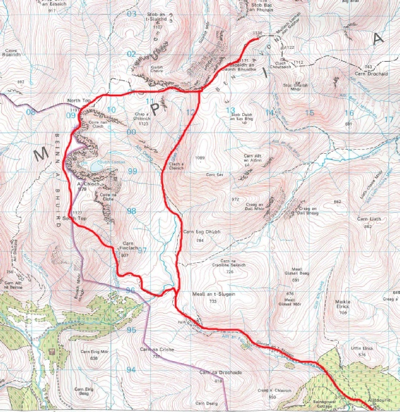
OS Map |
Land ranger 43 |
Weather |
Fair but mist on tops - |
|
Starting point : Keiloch car park 4 miles east of Braemar | |||
|
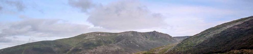
The route up Ben Avon and it’s sister was suggested by someone staying at the Braemar YHA at the same time as me. It appeared to be a good way to do the peaks with what appeared a shorter distance than the alternative route from the Linn of Quoich. The route started in effect for me at the YHA since I cycled along the A93 to the what is normally the start of the route, at the Keiloch car park. There followed a pleasant cycle up through woodland tracks and then onto the open hillside. A point was reached on the track where the going started to get very rocky and so that is where I left my bike. The route up Ben Avon is very obvious with a good path. Once at the bealach between Ben Avon and Beinn a'Bhuird a worn path heads east up onto the plateau and Ben Avon's summit would have come into view if it was not for the mist. Eventually, the granite tors of the summit loomed up out of the mist and I was then ready for the easy scramble to the highest point. A path was picked up heading down around the edge of the corrie to the bealach between Ben Avon and Beinn a'Bhuird. With the thick mist the next section to Beinn a'Bhuird's North Top was the most navigationally testing my summer 2014 Munro session with no clear features at all for guidance. The GPS was useful to confirm I was still on course and eventually I came across the cairn at the summit. The edge of the corrie was then used to guide the progress to the South Top and then a rocky steep descent lead onto the path and the walk back to the bike. A good day but shame about the mist. One to do again in fine weather. |